Pages

Monday, October 19, 2015

Prather

FACTS:

Prather is located in California in the county of Fresno.

The zipcode is 93651.

 It has an elevation of 1657 feet

 It is located 25 miles (40 km) northeast of Fresno

In 2011 Sierra Elementary and Auberry Elementary Schools closed their sites and elementary students began going to school at Foothill Elementary which was once Foothill Middle School.


There are 1,653 people living in Prather as of 2014.


BUSINESS:

You will find the majority of mountain businesses located in Prather.
Here you can visit the Prather Shopping Center where MarVal grocery store, Velasco's Mexican Restaurant, YoTown Yogurt, second hand stores, CVS, Central Valley Community Bank, gas stations, nail and hair salons, hardware stores, realty groups and doctors.
The High Sierra Ranger District is located in Prather.

HISTORY::

The name "Prather" honors Joseph L. Prather who came to California in 1872.

In 1912 Ben Kneeland and his wife left Selma for 160 acres one half mile east of Prather on Hwy 168.  They brought up 10 head of milk cows and took them three days to get the cows up to the foothills.

While the area of Prather carries the Prather name they never in fact owned property there.  The original Prather Post Office was located near the corners of Auberry and Lodge Road.  In 1914 George Kneeland moved to the area and wanted to establish the post office and wanted to name it Lodge.  Lodge however was already being used by another post office so they decided to name it Prather since it was on Prather land.  Here they built an adobe structure and sold beef, pork, apples, and wood to the power company.  

In 1935 the post office was closed and reopened in 1936 by Carol Page in a new location at the "Y" of Auberry and Morgan Canyon Road.  The store became Page's Store but the post office kept the name of Prather, and the location is now named for it.


photo from: Marvin L. Kientz Tales of the Sierra.
http://s3-media1.fl.yelpcdn.com/bphoto/R_poHp959c3cC1u4GSUYwQ/ls.jpg


Sources: 
Kientz, Marvin. Tales of the Sierra. Marvin L. Kientz. 2007. Print

Monday, October 12, 2015

Tollhouse

FACTS:

Tollhouse is located in California the county of Fresno.

The zipcode is 93667

The town is 7 miles southwest of Shaver Lake.

As of 2014 the population was 2,156 people.

Tollhouse got its name because the road was once a toll road that lead from Sarver Peak to Pine Ridge.

It is 1,919 feet in elevation.

The town once had an elementary school called Sierra Elementary School that has been closed for nearly 5 years.

The tribal headquarters for Cold Springs Rancheria of Mono Indians of California.

BUSINESS:

Some businesses in the area include a restaurant named Humphrey Station, dog groomer, a market and grill named Tollhouse Market, a gas station, an automotive garage, and a post office.

HISTORY::

The town was created around the 1860's around a lumber mill.

In 1867 a mill operator named J. Humprehy's hired 2,000 Chinese laborers to build a road. They opened the toll road and charged 10 cents per head of loose cattle, 50 cents for a horse and a rider, one dollar for a buggy, $1.50 for a wagon with oxen, or two cents per head of sheep or hogs. The last toll was collected in 1878.

A village began to grow around the boom town and J. Morgan opened up a blacksmith shop.
Chuck Yancey built a hotel for the teamsters to stay while working on various jobs.

After Highway 168 was built, the town slowly grew quieter as many travelers going to Shaver or the ski are of China Peak used that route instead.


http://www.sierranevadageotourism.org/images/otc/input/content/350/sie657DA65FC1396D1A1.jpg
https://fbcdn-profile-a.akamaihd.net/hprofile-ak-xaf1/v/t1.0-1/c127.37.466.466/s160x160/281550_143911592355352_1866002_n.jpg?oh=b4564f363e4bc527ac77c0fab68921c7&oe=566FEE76&__gda__=1450727661_6f1ff63499aa3d50773e4d36c6626e70

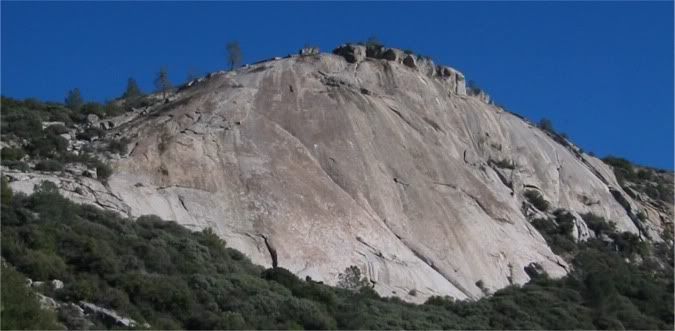
http://i21.photobucket.com/albums/b300/GeneMalone/TollhouseRock.jpg

http://www.midcalminis.org/wp-content/uploads/2012/04/Humphreys-Station-circa-2010.jpg


Information Resources:

http://geonames.usgs.gov/apex/f?p=gnispq:3:0::NO::P3_FID:1660011
http://www.sierranevadageotourism.org/content/tollhouse-california/sieD697B750E21C6749D

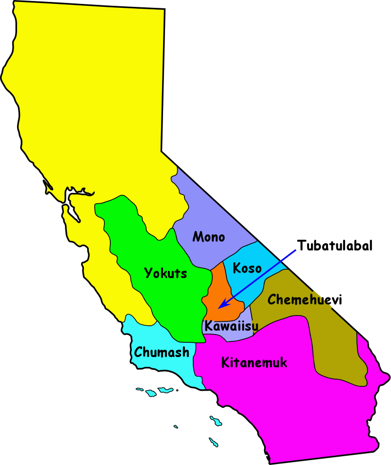
California Yokuts Research Project

Welcome FOURTH Graders!

Today you will be taking notes on the Yokut Tribe using the internet.  Please use the handouts your teacher provided to help you organize your notes as you learn about this tribe.
http://www.bsahighadventure.org/indian_lore/indian_map.gif


Use your Yokut Note Taking Sheet 1 for this website:

California Indians Fact Card: Yokuts


Use your Yokut Note Taking Sheet 2 for this website:
What-When-How: Yokuts


Have fun learning about the Yokuts!

Sunday, October 4, 2015

Auberry

FACTS:
Auberry is located in California in the county of Fresno.

The zipcode is 93602

It is a small mountain town east of Fresno.

The population in 2010 was 2,369 people.

Auberry got its name by mistake.  It was supposed to be named after a man named Al Yarborough but it was mispronounced and recorded as "AUBERRY."

There are two main parts of Auberry: New Auberry and Auberry.

The town once had an elementary school named Auberry Elementary School that has been closed for almost five years.

BUSINESS:
Some businesses in the area include automotive repair shops like Paul's Auberry Garage, Bruce's Auto, and Dave's Auto.
There is a local market named Ponderosa Market that was built in the site of the old Burlow Hotel by Barney and Mary Amundsen.  Across the street is Velasco's Mexican Restaurant.
Auberry is home to a cabinet makers, tavern owners, accountants, and yoga instructors.
Daddy Joe's Java Time was established in 1997 and still offers breakfast and coffee to customers.
Across the street from Java Time is a Fresno County Public Library called the Auberry Library.
Auberry has a post office, churches, Auberry Feed Store, and a dance studio called Studio on the Hill. The town includes eye doctors, physical therapy, dentists, a doctor, propane distributors, and veterinary services.

HISTORY:
In 1880 F.F. Witham built the first store on a dirt road
In 1912 a railroad was built called the San Joaquin and Eastern Railroad.  The railroad was 56 miles long and took 157 days to complete using hand labor, horses, mules, and Fresno Scrapers.  It was built to help construct the hydroelectric plant for Pacific Light and Power Company, now Southern Cal Edison to provide electricity to Southern California. The trains were used to carry lumber and agricultural product. Because the railroad was expensive, very crooked, and not a smooth ride, it was quickly nicknamed "The Slow, Jerky, and Expensive."  The railroad was no longer needed and closed in 1933.

The train went through the town of Auberry and has a street named for it, the SJ+E Road.  You can drive on this road today.
http://www.sierranevadageotourism.org/images/otc/input/content/350/sie8CA241C2C9300A920.jpg
http://auberrygarage.com/assets/images/auberry-garage.jpg
http://www.friendsofauberrylibrary.org/files/3714/1322/8447/AuberryLibrary_AuberryCA.jpg


http://www.gearedsteam.com/climax/images/san_joaquin_n_eastern_rr_105.jpg


Sources:
San Joaquin and Eastern Railroad: 
http://www.sierranevadageotourism.org/content/historic-san-joaquin-eastern-railroad-grade/sie545C4FC5819EF0340

http://www.examiner.com/article/the-san-joaquin-eastern-was-one-slow-jerky-expensive-railroad

Auberry:
http://www.sierranevadageotourism.org/content/auberry-california/sie2BC90C0B0C1ED97DB