Monday, September 14, 2015

The Desert

FACTS

There are three main deserts in California: the Mojave, Colorado and the Great Basin deserts. The Mojave Desert is bounded by the Tehachapi Mountains on the northwest, and the San Gabriel and San Bernardino Mountains on the south. It extends eastward to California's borders with Arizona and Nevada and also forms portions of northwest Arizona. The Colorado Desert lies in the southeastern corner of California, between the Colorado River and the Transverse Ranges, and continues into Mexico and Arizona to the south and east, though in these areas it is called the Sonoran Desert. The Great Basin desert lies immediately to the east of the Sierra Nevada cordillera and extends eastward into the state of Nevada.

The desert is marked by very low rainfall.  The Mojave Desert receives fewer than 13 inches of rain. Summer weather is dominated by heat.  Temperatures can skyrocket to above 120 degrees.  Autumn in the Mojave Desert is the most pleasant time to be there with temperatures between 70-90 degrees.

The Great Basin Desert is considered the "cold desert" because it is a higher elevation and gets 7-12 inches of rain yearly.  There is even snow there sometimes!

The Colorado Desert has greater summer daytime temperatures and almost never has frost.  It has two rainy seasons per year.  One in the winter and late summer.


Source: http://www.ask.com/geography/california-desert-region-e50ce271a8fc2b39


CITIES 


http://dogtrekker.com/userfiles//Desert-Region-Map_opt.jpg

CLIMATE

The California deserts include the hottest average temperature on the planet at Death Valley, and lowest land elevations in the U.S. Explore this amazing California attraction that offers incredible things to see and do. In the California deserts region are Imperial, Riverside, San Bernardino and Inyo Counties. The Sonoran Desert in California is the LOW Desert, and the Mojave Desert is the HIGH Desert.  As of 2014, the highest temperature ever recorded on the surface of the earth, 134 degrees Fahrenheit, was recorded at Death Valley National Park, part of the California desert region.  There is very rare rainfall in this region.  However, when it does rain plants are able to soak up water during this time and store it for months or even years.

Source: http://www.visitcalifornia.com/region/discover-deserts

For local valley weather:


ANIMALS

Foxes
http://www.fhwa.dot.gov/publications/research/safety/08034/images/image028.jpg

Roadrunners
http://www.desertusa.com/birds/photos/993040_n.jpg
Snakes
http://s3.amazonaws.com/production.reserve123/images/product/451-5.jpg
Lizards
http://www.in-the-desert.com/enlarge/012lizard.jpg
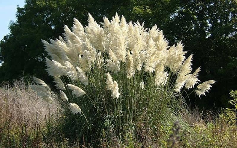
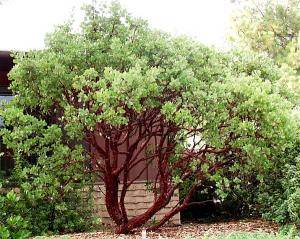

PLANTS

The deserts of Joshua Tree National Park have giant boulders and alien-like yucca plants.
http://kenshikingsticks.homestead.com/yucca_1.jpg
Sagebrush
http://www.usu.edu/weeds/plant_species/nativespecies/nativespeciesimages/sagebrush/UT052102MD05_2.JPG
http://www.desertusa.com/flora/photos/No1mesquite-tree.jpg
Cactus
https://jimcaldwell.files.wordpress.com/2012/11/joshua-tree-and-the-desert-landscape_002.jpg

Resource: California Geography (C) 2009 splashpublications.com

The Valley

FACTS
Although the term "the Valley" refers to an area stretching from Shasta to Kern, that area doesn't refer to a single community by any means. 
The length of the valley is about 450 miles.
The Central Valley is the world’s largest patch of Class 1 soil.  The soil produces many different varieties of food that feeds much of the state and other states as well!

6.5 million people live in the valley. About 6.5 million people live here and there are 12 metro areas in the Valley. It is one of the fastest growing regions in California. The largest city is Fresno the valley also includes the state capital, Sacramento. The Sacramento and San Joaquin rivers, which run through the Central Valley, are fed mainly by the abundant rains and melting snows of the Sierra Nevada’s western flank. The development of ranching and agriculture in the valley progressed rapidly after the California Gold Rush in 1849. Because of the irrigation made possible by numerous dams and canals, the area now contains some of the richest farmland in the United States and produces more than 300 crops, including cotton, fruits (wine grapes, peaches, apricots), grains (wheat, rice), nuts (pistachios, almonds), and vegetables. With about 300 growing days per year, the valley produces about one-fourth of the food consumed in the United States. 

Source: http://www.britannica.com/place/Central-Valley-California

CITIES 

state_map

http://www.mastersuites.net/blog/7-mind-blowing-facts-about-central-valley-california

CLIMATE

Characterized by high temperature and low humidity in the summer and low temperature and high humidity in the winter. Both the Sacramento and San Joaquin Valleys exhibit this type of climatology.

Long ago, woods, grasslands, and wetlands covered the Central Valley. People filled in many of the wetlands to make farmland. Because of the Central Valley’s rich soil and long growing season, it supplies about half the country’s fruits, vegetables, and grains. With little rain in the summer, dams, channels, pumps, and ditches are used to bring water. The Valley climate makes it possible for farmers to grow crops year round.

Source: https://www.eduplace.com/ss/socsci/ca/books/bkd/ilessons/ils_gr4_ca_u1_c01_l3.pdf

For local valley weather:


ANIMALS

Muskrat
http://www.wildlifedamage.com/images/Charlottenburg_muskrat_small.jpg
Beavers
http://cdn.zmescience.com/wp-content/uploads/2014/12/beaver.jpg
Ducks
http://www.birdinginformation.com/wp-content/gallery/mallard_duck/mallard-duck-7a.jpg
Heron
http://antpitta.com/images/photos/herons/Great-Blue-Heron-tarcoles_1410.jpg
Newt
http://www.californiaherps.com/salamanders/images/ttorosabr306.jpg


PLANTS

Pampas Grass
https://e54055a024bc6fb58d47-f7df714a3b816a175961a96ef2278d84.ssl.cf2.rackcdn.com/5746-Pampas-Grass.jpg

Poppy
https://upload.wikimedia.org/wikipedia/commons/2/2b/California_poppy_1.jpg
Blue Oak
http://www.blueplanetbiomes.org/images/qdouglasiiform.jpg
Lupine
http://www.geog.ucsb.edu/~joel/g148_f09/lecture_notes/transverse_ranges/bush_lupine1.jpg
Ceanothus
http://www.cptmedianews.com/almadenvalley/images/ceanothus.jpg
Resource: California Geography (C) 2009 splashpublications.com

Mountain Region

FACTS
The California mountain region is made up of two main mountain areas.
The first is the Coast Ranges near the California coast.  The second is the Inland Mountains consisting of the Sierra Nevada Mountains and the Cascade Mountains.
The Cascade Mountains are unique because millions of years ago they were formed by volcanoes.  When the lava oozed from the Earth's crust and cooled they hardened into mountains.  One active volcano is Lassen Peak located in the Cascade Mountains.
The Sierra Nevadas span nearly 400 miles across California.  The name Sierra Nevada is Spanish for "snowy range."
A mountain is considered a "mountain" if it reaches at least 2,000 feet above sea level.
The highest peak in the contiguous U.S. is Mount Whitney at 14,505 feet, located within the Sierra Nevada.  Glaciers moved across the high mountains millions of years ago and carved deep canyons through the Sierra Nevadas.  When the glaciers melted, hundreds of streams and lakes were created.  In the higher elevations peaks of the mountains are covered with snow all winter long.

CITIES 


http://www.citytowninfo.com/images/state-maps/california-reference.gif

CLIMATE

The Coastal Mountain range is located near the ocean and extends through two-thirds of the state. The coastal side is typically foggy, moist and cool, while on the eastern side, the temperatures are higher, and there is less precipitation.
California's large eastern Sierra Nevada range has a Mediterranean-like climate below 6,000 feet. Winters are wet and cool, while summers are warmer and drier. The highest regions have snow year-round, but most of it accumulates during the winter months.
http://www.ask.com/science/climate-california-s-mountain-region-306fc782b154bd61

Unique to the region is a phenomenon called the Rain Shadow Effect.
According to National Geographic rain shadow is a patch of land that has been forced to become a desert because mountain ranges blocked all plant-growing, rainy weather. On one side of the mountain, wet weather systems drop rain and snow. On the other side of the mountain—the rain shadow side—all that precipitation is blocked.

In a rain shadow, it’s warm and dry. On the other side of the mountain, it’s wet and cool. Why is there a difference? When an air mass moves from a low elevation to a high elevation, it expands and cools. This cool air cannot hold moisture as well as warm air. Cool air forms clouds, which drop rain and snow, as it rises up a mountain. After the air mass crosses over the peak of the mountain and starts down the other side, the air warms up and the clouds dissipate. That means there is less rainfall.


https://www.youtube.com/watch?v=ez99nyfSHCk

For local mountain weather:


ANIMALS
mountain lion
Mountain Lion
https://www.wildlife.ca.gov/Keep-Me-Wild/Lion

mule deer
Mule Deer
https://www.wildlife.ca.gov/Keep-Me-Wild/Deer

coyote
Coyote
https://www.wildlife.ca.gov/Keep-Me-Wild/Coyote
Red-tailed hawk
Red Tailed Hawk
http://ewombat.com/doc/species/animalia/chordata/aves/accipitriformes/accipitridae/buteo_jamaicensis.html

Turkey Vulture
http://ewombat.com/img/photo500/species/animalia/chordata/aves/accipitriformes/cathartidae/20101129-001659.jpg

California Golden Trout
http://www.streamexplorers.org/atf/cf/%7B91C7DE6A-1064-4F57-87A6-5D8786DA1F8E%7D/GOLDEN-TROUT.jpg

PLANTS

Douglas Fir
https://www.extension.iastate.edu/forestry/iowa_trees/tree_id_photos/FIR_DOUGLAS_form.jpg


Manzanita
https://www.villagenurseries.com/wp-content/uploads/2014/07/201_img.jpg

Sage Brush
http://www.salmonvalley.org/wp-content/uploads/2013/04/sagebrush-1.png
Snow Plant (Sarcodes sanguinea)  San Bernardino Na...
Snowplant
http://www.mountainproject.com/v/106495882
Mountaineer Shooting Star (Dodecatheon redolens)  ...
Mountaineer Shooting Star
http://www.mountainproject.com/v/106495899

Resource: California Geography (C) 2009 splashpublications.com

The Coast Region

FACTS
The California coast region is 1,264 miles starting at the Oregon border and stretching to Mexico in the south.

The California coast is known for its rocky shores and chilly waters.  The bay of San Diego  and San Francisco are California's only natural bays. 

More than half of California's population reside in the coastal area.  

The San Andreas  Fault is an important feature of the coast ranges.  It is the longest fault in California.  A fault is a break in the Earth's rocky outer shell.  Below the shells are giant plates made of rock.  Movement along the fault lines make the plates grind against each other.  This causes the plates to break loose.  A lot of movement in these plates cause earthquakes.

CITIES 


http://boredfeet.com/bluewater/blueh20.jpg

CLIMATE

You will find that the California coast has weather that is very mild throughout the year.  The summers tend to be dry and there is moderate rainfall the rest of the year.  It is very unlikely that you will see snow on the coast.  
Because of the unique qualities of the coast, the wet climate helps the forests to grow.


Mendocino, Sonoma, and Napa counties are known as Wine Country because the climate is perfect for  growing grapes to make wine.

The northern coast is known for its fog when it rolls in from the Pacific Ocean.  This helps to make the climate cool and wet. 
The southern portion of the coastal region has a warmer temperature and is sunny nearly all year long.
ANIMALS
 The California coastline offer shelter to a many wildlife.  Much of California's coastal region is protected by the U.S. and California state governments to ensure the survival of these animals. To see the vast array, you can travel California's coast and visit parkways and hiking trails that offer a chance to see these animals up close.

Read more : http://www.ehow.com/info_8082446_animals-plants-california-coast.html
Fog Shrew 
Fog Shrew
http://www.sibr.com/mammals/M005.html
Deer Mouse
Deer Mouse
http://sibr.com/mammals/M117.html
Sharp-tailed Snake
Sharp-tailed Snake - Contia tenuis
(Pleasanton)
http://www.sfbaywildlife.info/species/reptiles.htm
Gray Whale
Gray Whale - Eschrichtius robustus
Photo credit: Merrill Gosho, NOAA
http://www.sfbaywildlife.info/species/marine_mammals.htm
Sea Otter
Sea Otter - Enhydra lutris (Moss Landing)
http://www.sfbaywildlife.info/species/marine_mammals.htm

Northern Elephant Seal
 Elephant Seal - Mirounga angustirostris (Ano Nuevo State Park)
http://www.sfbaywildlife.info/species/marine_mammals.htm

PLANTS
California's redwood trees grow easily in the coastal region.  The coast region is very rich in soil and mineral deposits making it an important for growing crops.


Seaside Daisy
http://www.pnwplants.wsu.edu/Handler.ashx?Size=M&ImageID=1575

Sea Thrift
http://conservationgardenpark.org/file/8f00cf04-3822-4bca-8e7b-b8e1522103a5/Sea-Thrift-Armeria-maritima.gif

Rattlesnake Weed
http://www.namethatplant.net/Images/ImagesFire/jkm10/jkm100427_120.jpg
Redwood Trees
http://ww2.kqed.org/science/wp-content/uploads/sites/35/2013/08/redwood.jpg
Baccarhis Pigeon Point.
Coyote Brush
http://www.laspilitas.com/nature-of-california/plants/114--baccharis-pilularis-pilularis-pigeon-point

Resource: California Geography (C) 2009 splashpublications.com

CALIFORNIA REGIONS

Welcome Fourth Graders to your California Regions Web Page!

California is the third largest state in the United States and is divided into four regions.
California's four major land regions are the mountains, valley, coast, and desert.

Each region has its own special characteristics that help make up the great state of California!


Here you will learn about: